
Chino ZIP Codes and Their Reach
The Chino ZIP code directory has two documented general-delivery ZIPs in the research. 91710 reflects much of established and central Chino, while 91708 serves the newer southern and eastern growth story. USPS assigns a ZIP for delivery, so the postal polygon and the city boundary do not have to match.
| ZIP | Areas or uses covered | Post-office context | Notes |
|---|---|---|---|
| 91710 | Established, northern, and central Chino; nearby boundary addresses may share the postal city | Chino general delivery | Check city jurisdiction parcel by parcel |
| 91708 | Southern and eastern growth area, including The Preserve and College Park vicinity | Chino delivery ZIP | Modern tract geography differs from historic core geography |
No official research source supports adding 91709, 91761, 91762, 91766, or 91768 to a Chino postal list merely because adjacent cities use them. Verify a particular mailing line through USPS, then check the city and APN separately.
Chino ZIP Mailing Lines and Boundaries
USPS uses ZIP codes to route mail, not to draw a municipal limit. A “Chino, CA” last line can sit near another jurisdiction or a planning edge. The USPS address lookup verifies the delivery ZIP. The Chino Land Use Viewer helps verify the city-side geography, while County Parcel Access supplies the APN and parcel context.
The three systems use different keys. USPS uses a deliverable mailing address. The city map uses address or APN and displays planning geography. The assessor uses APN and situs, with mailing information serving a separate notice function. The combined result should preserve all three answers instead of replacing them with one label.
- ZIP code
- A USPS delivery area label, not a legal city boundary.
- ZIP+4
- An expanded delivery code that narrows routing beyond the five-digit ZIP.
- Carrier route
- A postal delivery path inside a ZIP, not a resident roster.
- Unique ZIP
- A ZIP assigned to a special institution or high-volume destination; no separate Chino unique ZIP was verified.
The most reliable postal result states the USPS answer, city-jurisdiction answer, and APN answer in separate fields.
Chino ZIP 91708 Growth Geography
91708 is tied to Chino's southeastern growth areas, including The Preserve and the College Park vicinity. Those names come from the city's planning and communities-of-interest geography, not from a claim that every address in a planning area shares one exact postal shape. Modern planned tracts are more likely to have tract, lot, permit, and community-facility clues than a historic core address.
The strongest dated explanation is USPS Postal Bulletin 22179, dated April 27, 2006. It records a July 1, 2006 realignment of 450 deliveries from 91710 to 91708 and directs the use of “Chino CA 91708” as the last line. That postal change helps explain why a modern Chino address can sit in a different ZIP than an older directory or deed.
The captured address lookup source is the USPS address-to-ZIP form.
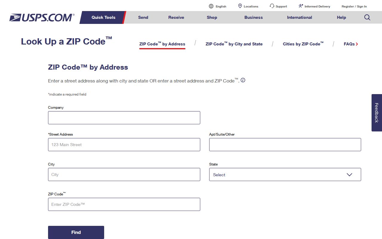
USPS verification is the first step before a ZIP is used to narrow a resident or parcel search.
Chino ZIP 91710 Historic Core
91710 remains associated with established and central Chino, including the older street grid and the core around Central Avenue. That description is a research orientation, not a block-level polygon. Older addresses can appear in regional city directories, Sanborn sheets, newspapers, and county deed books while the current ZIP is assigned through a later postal route.
Use the postal directory as a narrowing clue. Then verify the address in the city map and county parcel layer. If the question is who lived there in an earlier year, the city directory and census route is stronger than a present ZIP. If the question is which parcel is in the city, the APN and city viewer are stronger than the mailing line.
Chino's major road references, including Central Avenue, Euclid Avenue, Chino Avenue, Riverside Drive, Schaefer Avenue, and Edison Avenue, can help disambiguate a notice or old address. Road proximity does not change a ZIP's delivery purpose.
Finding Residents by Chino ZIP Code
A ZIP search should filter a known address or a defined public dataset, not create a private roster. Use the five-digit ZIP to organize records, then retain the exact address and date used. The postal directory is most useful when it hands a narrowed question to the proper custodian.
- Verify the complete delivery address and ZIP with USPS, including the last line.
- Check Chino's map for city planning geography and the county map for APN and situs.
- Choose the record source that fits the question: parcel, deed, permit, court, business, license, or historical directory.
- Search by the source's key, such as APN, party name, case number, entity number, or publication year.
- Record the ZIP as postal context only, then confirm any resident or parcel conclusion with the source's own fields.
For street-level work after a ZIP narrows the area, use the Chino street directory by address. The handoff matters because ZIP filters and address records answer different questions.
Chino ZIP Search Versus APN
A ZIP label is a postal filter. An APN is a county assessment key. They can point to the same address, but they are not interchangeable. The county assessor's map can show parcel geometry, characteristics, valuation context, and tax-district information. It warns that assessment data are not legal title and that personal owner or address fields have statutory protections.
| USPS address tool | Complete mailing address and ZIP verification for delivery. |
|---|---|
| Chino Land Use Viewer | Address or APN, street or aerial basemap, map click, share, print PDF, help. |
| County Parcel Access | APN, situs, parcel geometry, characteristics, value and transfer context. |
| Recorder index | Grantor, grantee, date, document number and type after a party clue is known. |
The APN is not a permanent legal description. A split, merger, tract change, or planned development can alter the assessment key. A postal code can also change through route realignment without a property transaction. Keep the date beside both values.
Chino Postal Geography and Places
Chino's official communities-of-interest map distinguishes Downtown, Park East, College Park, The Preserve, the agricultural community north of SR-60, and numbered voting districts. Those labels are useful search vocabulary. They can guide a request for a planning map, permit, community document, or local-history source, but they are not membership rosters and do not replace the ZIP or APN.
The newer southeastern areas are more likely to have modern tract maps, Accela permit records, and planned-community documents. The older core is more likely to intersect regional city directories, Sanborn sheets, older deeds, and newspaper notices. A postal filter can place an address in the right broad geography before the record trail changes era.
Keep geography descriptive. Do not infer a person's identity, household, or affiliation from a community name, ZIP, language, or demographic statistic.
Chino ZIP 91708 Post Office Detail
The Chino Post Office facility record places the office at 5375 Walnut Avenue, Chino, California 91708-9998, with phone 909-364-1361. Published retail hours are Monday through Friday 8:30-5 and Saturday 9-2. PO Box delivery is listed at 11 Monday through Saturday. The facility's own 91708 address is a useful reminder that a post office location does not describe the full delivery polygon it serves.
USPS routing documentation maps both 91708 and 91710 under Chino. The research did not verify a separate Chino PO-box-only or institution-unique ZIP. Avoid adding one because a directory or mailing label uses a special suffix. Verify each complete address through USPS.
The post-office source captured for the Chino ZIP code directory is the USPS Chino Post Office record.
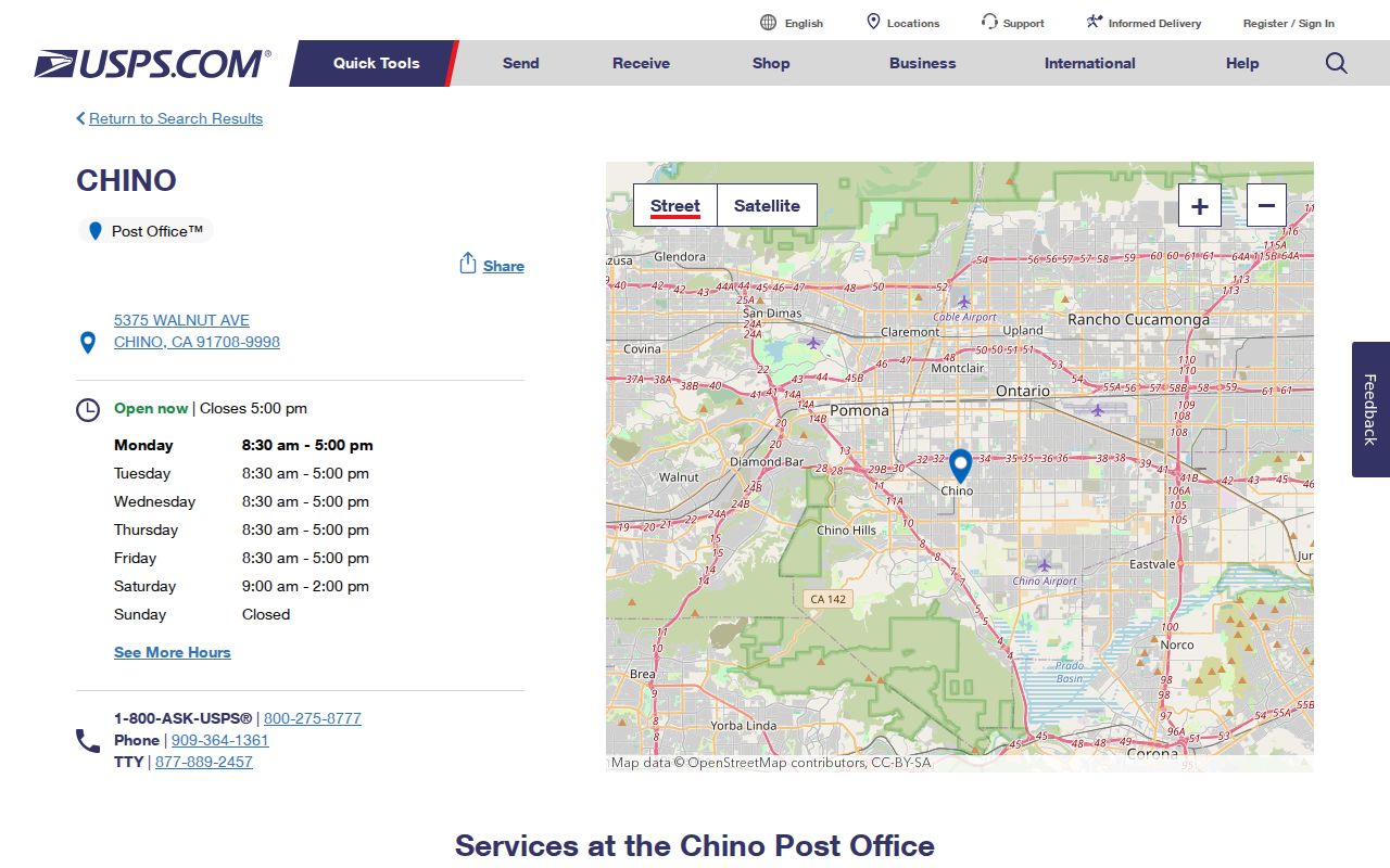
The facility address is a postal-service fact, not a statement about every route or city parcel using 91708.
Compare Chino Postal Geography
The comparison is simple but important: 91710 is tied to much of the established core, 91708 to southeastern growth, yet neither ZIP is a city-limit map. USPS delivers mail. Chino controls its land-use and planning information. San Bernardino County assesses parcels and records deeds. A resident or property conclusion needs the source that owns the fact.
| Question | Best first source | What to retain |
|---|---|---|
| Where should mail go? | USPS address lookup | Complete address, five-digit ZIP, and any ZIP+4 |
| Is the parcel in Chino planning geography? | Chino Land Use Viewer | Map date, APN or address, basemap, and print extent |
| What parcel is involved? | County Parcel Access | APN, situs, geometry, and legal-description clues |
| Who is a recorded party? | County Recorder Index | Name, role, recording date, document number and type |
There is no official block-level city and ZIP mismatch table in the research. Census ZCTAs are statistical approximations, not USPS delivery boundaries. Avoid turning a broad ZIP description into a precise neighborhood claim.
Unverified Chino ZIP Claims
The research did not locate station-by-ZIP neighborhood polygons, per-ZIP population counts, or a complete city-limit mismatch table. It also found no evidence for a separate Chino PO-box-only or unique ZIP. These gaps are useful boundaries. A postal directory can verify a delivery address and provide an organizing filter, but it cannot supply every person who receives mail in the ZIP.
Residents may use a substitute address through Safe at Home, and voter data carry confidentiality restrictions. A delivery route, APN, or tax account does not reveal every occupant. The responsible next step is a narrow official request or a documented map check, not an expanded private list.
Note: ZIP history can explain a changed mailing line, but it cannot by itself date a move or establish residence.